There is currently no text in this page. You can search for this page title in other pages, or search the related logs, but you do not have permission to create this page.
No higher resolution available.
Europe_in_1812.PNG (536 × 399 pixels, file size: 458 KB, MIME type: image/png)
File history
Click on a date/time to view the file as it appeared at that time.
| Date/Time | Thumbnail | Dimensions | User | Comment | |
|---|---|---|---|---|---|
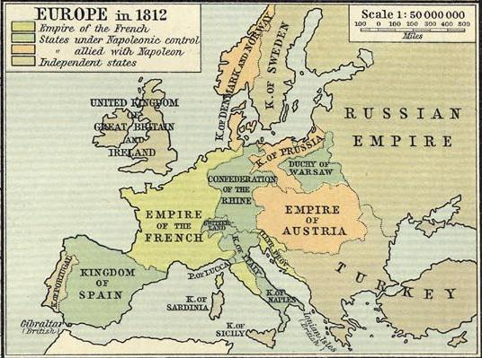
| current | 19:58, 28 January 2009 | | 536 × 399 (458 KB) | templates>wikimediacommons>R'n'B | {{Information |Description={{en|1=Political map of Europe in 1812, showing boundaries immediately prior to Napoleon's invasion of Russia}} |Source=Historical Atlas. New York: Henry Holt and Company copy available at http://www.lib.utexas.edu/maps/historic |
File usage
The following file is a duplicate of this file (more details):
- File:Europe in 1812.PNG from Wikimedia Commons
The following page uses this file: